
By Brandt Hart
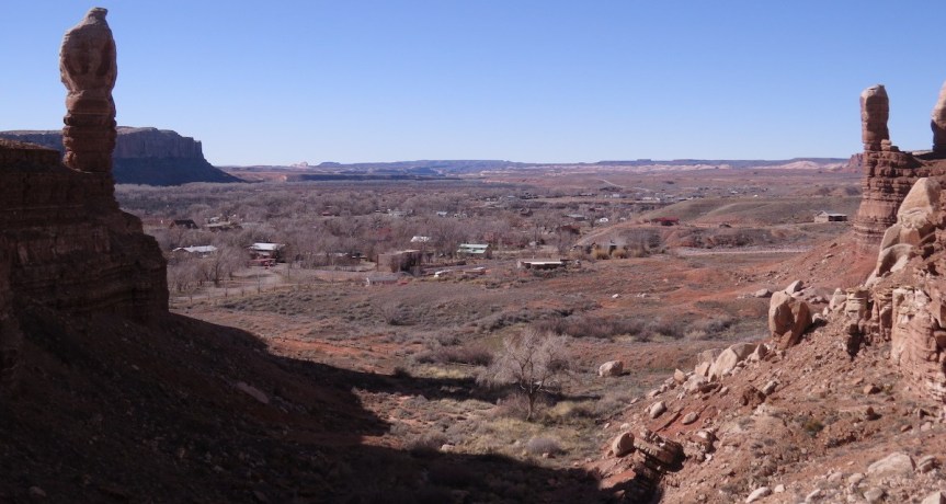
One of my favorite history geek things to do is to line up a historic photo, snap a retake, and analyze the matching images taken years apart. Like I said, geek. I see the world as a dynamic system where change is constant but often occurs at a rate unnoticed by most. Comparing matching images of the exact same location can bring change, or the lack of change, into greater focus and deepen our understanding of history. There are a few differences worth noting between these two images, taken 124 years apart.
The greatest difference is the change in vegetation, which is common in local retakes. The foreground in the 1895 shot is nearly devoid of vegetation. Perhaps the proximity to town made it an easy and frequent target for the livestock herds that most families in 1895 kept. Trees in Bluff proper as well as the lone cottonwood tree in the foreground have matured noticeably over the years.

Where did the river go? One of the largest changes illustrated has occurred along the river. Missing today is the wide sandy river bottom. The completion of Navajo Dam in 1962, water diversions, dikes, the introduction of invasive tamarisk and Russian olive trees, and other factors have altered the flow and ecology of the river. The river channel has narrowed considerably, and this narrowing is still occurring today.
A meticulous comparison of the talus slopes reveals a few boulders are missing. What happened to these heavy rocks? With no known local quarry, the sandstone blocks needed to construct the pioneer school, church, many houses, and other structures were simply crafted from boulders conveniently scattered on the slopes around town. Furthermore, the prominent balanced boulder on the flats in the foreground has silted in, likely due to the presence of a constructed stock pond/check dam nearby.
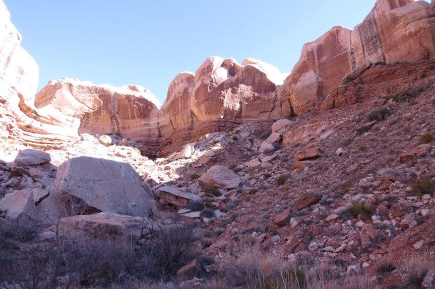
Fellow history geek and Bluff resident Jay Willian observed that a “dagger” of morning sun slowly migrates its way across the slope to the photographer’s location, a steep slope in the cove behind the Twin Rocks formation. Jay states, “Interestingly, it seems clear he took the photo mere minutes before the sun reached him.” Maybe prospector-turned-photographer Charles Goodman knew his shot would have been drenched in direct sunlight and closed the shutter before suffering the consequence of having his glass plate negative overexposed.
In a completely unplanned and odd astronomical coincidence, February 7, the date of Jay’s retake photo, is exactly the same number of days away from winter solstice as is November 4th, the date of the original photo. Therefore, the sun’s angle and the important shadows it casts are identical.
Stay tuned for more “then & now” geek-out photo comparisons in future editions of the Canyon Echo.
-Brandt Hart is a River Ranger on the San Juan River. He is also a professional cat herder and assists his wife in wrangling two wolf-pups, commonly referred to as the Hart boys. In his free time, he enjoys fixing and painfully crashing abandoned scooters at the Blanding skatepark.
-Jay Willian is an archaeologist in Bluff, Utah. He shares a dog named Spirit. His birthday, April 6th, is the same day that weary Hole-in-the-Rock pioneers decided to stop their trek and call Bluff home. In 2016, he won “Bluff’s Best Costume” with a Halloween creation he called “Octopus’s Garden”.
